Plat
2023.44.7
from the collection of
Title
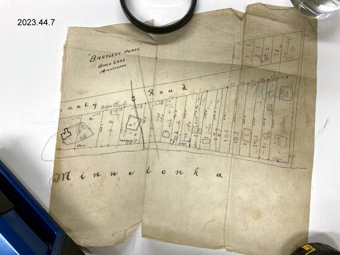
Plat Map of "Bartlett Place" Upper Lake Minnetonka, Mound, MNDimensions
10" H x 10" W
Description
Plat map of "Bartlett Place" Upper Lake Minnetonka, Mound, MN.Cook's Bay shown on south boundary (bottom).
Buildings and channel outlines are penciled onto plat.
County Road 7 (Bartlett Blvd) shown.