Aerial Photo
E2721
from the collection of
Title
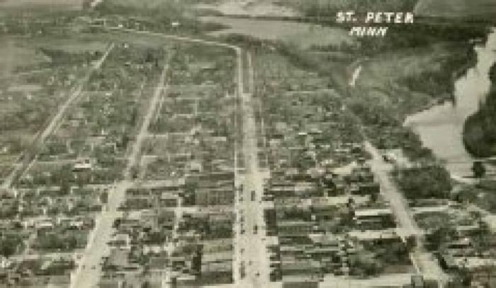
Aerial view of St. PeterCreation Date
1930Dimensions
3.0 H x 5.2 W
Description
Aerial view of St. Peter. B/W postcard of an aerial view of portions of St. Peter, including parts of the business district. The Broadway Bridge that was replaced about 1930 can be seen at the far right. This photo is dated 1930 on the reverse. Grace Street runs along the bottom of the postcard. The entire boulevard that began at Skaro Street on North Minnesota Avenue and extended northward along the avenue for several blocks can be seen in the top center portion of the postcard. The portions of North Fourth Street that then extended northward from Broadway can be seen at the far left. Most of the roof of the old Powerhouse immediately to the west of the Mill Pond can be seen just south of Nassau Street on the far right. Many of the business buildings along South Minnesota Avenue and along South Third Street can be seen. The Post Office, the old Fire Station that was next to it, and Lincoln School can also be seen.Related People and Organizations
Hoffman, Janet